Home » Observatoire du Sahara et du Sahel (OSS) – Tunisie
Observatoire du Sahara et du Sahel (OSS) – Tunisie
OBSERVATION DE LA TERRE POUR LA GESTION DURABLE DE L’EAU ET DES RESSOURCES NATURELLES EN AFRIQUE DU NORD
L’Afrique du Nord est confrontée à des défis majeurs tels que la sécheresse et la désertification. 70 % de l’eau utilisée dans la région est destinée à l’irrigation. L’Observatoire du Sahara et du Sahel (OSS et ses partenaires oeuvrent à l’amélioration de la gestion de l’eau et des ressources naturelles grâce au renforcement des capacités, à la sensibilisation, et à l’utilisation de données et d’outils d’observation de la Terre. Les services liés à l’agriculture et à la dégradation des sols fournis par le projet améliorent la qualité de vie des communautés en minimisant l’importation de nourriture, en atteignant des niveaux plus élevés de sécurité alimentaire et en disposant de plus de terres pour l’agriculture grâce à la lutte contre la dégradation des sols.
Responsable du Consortium : Observatoire du Sahara et du Sahel (OSS) – Tunisie.
Couverture Géographique : Algérie, Egypte, Libye, Maroc et Tunisie.
Orientation : Trois (03) services ont été développés dans le cadre du projet :
- La surveillance des cultures saisonnières et alerte précoce ;
- Estimation des prélèvements et contrôle de l’utilisation de l’eau dans les zones irriguées ;
- Surveillance de la dégradation des sols.
L’approche participative impliquant les utilisateurs finaux dans le processus de développement des services et le solide dévouement des partenaires du projet ont permis de développer deux plates-formes opérationnelles et complémentaires hébergeant des géoservices, en particulier MISLAND (www.misland.oss-online.org) pour la surveillance de la dégradation des sols et MISBAR (www.misbar.oss-on- line.org) pour la surveillance des cultures saisonnières et l’utilisation de l’eau à des fins agricoles.
Site Web : http://misbar.oss-online.org
EARTH OBSERVATION FOR SUSTAINABLE MANAGEMENT OF WATER AND NATURAL RESOURCES IN NORTH AFRICA
North Africa faces major challenges such as drought, and desertification. 70% of water use in the region is for irrigation. The Sahara and Sahel Observatory (OSS) and its partners aim to improve water and natural resource management through capacity building, awareness, and using EO data and tools. The agriculture and land degradation services provided by the project improve communities’ quality of life by minimizing food importation, reaching higher levels of food security, and having more land for agriculture by combating land degradation.
Consortium Leader: Sahara and Sahel Observatory (OSS) – Tunisia.
Coverage: Algeria, Egypt, Libya, Morocco, and Tunisia.
Focus: Three (03) services were developed under the project:
- Seasonal Agriculture Monitoring and Early Warning;
- Estimating withdrawals and Water Use Monitoring in irrigated areas;
- Land Degradation Monitoring.
The participatory approach involving end users in the service development process and the strong commitment of project partners has made it possible to develop two operational and complementary platforms hosting GeoServices, in particular MISLAND (www.misland.oss-online.org) for land degradation monito- ring and MISBAR (www.misbar.oss-online.org) for seasonal agriculture monitoring and agricultural water use.
Website: http://misbar.oss-online.org
Publications

Integration of a module focusing on GMES and Africa services into CRASTE-LF curricula
The GMES and Africa Consortium in charge of developing EO-based services on Water and Natural resources in North Africa, led by the Sahara and

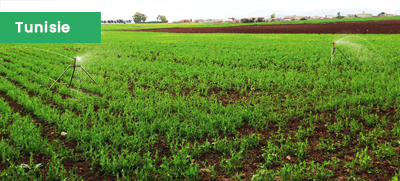
Valorizing EO data from the GMES and Africa’s agriculture monitoring service to produce seasonal crop-types maps (Jendouba and Kairouan, Tunisia)
The GMES and Africa Consortium in charge of developing EO-based services on Water and Natural resources in North Africa, led by the Sahara and

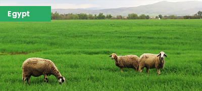
Land Degradation Monitoring and Assessment in Governorates of Matrouh, Alexandria, and Sinai, Egypt
The GMES and Africa Consortium in charge of developing EO-based services on Water and Natural resources in North Africa, led by the Sahara and

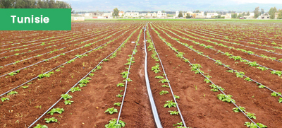
Assessment of the Water Needs of Plants to Support Farmers and Irrigation Managers in the Governorate of Manouba, Tunisia
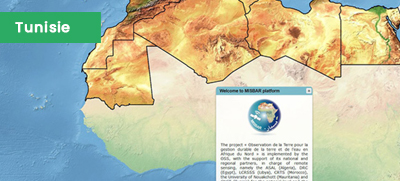
Since 2017, under the GMES & Africa Support Program, the consortium led by the Sahara and Sahel Observatory (OSS) has been implementing an EO-based